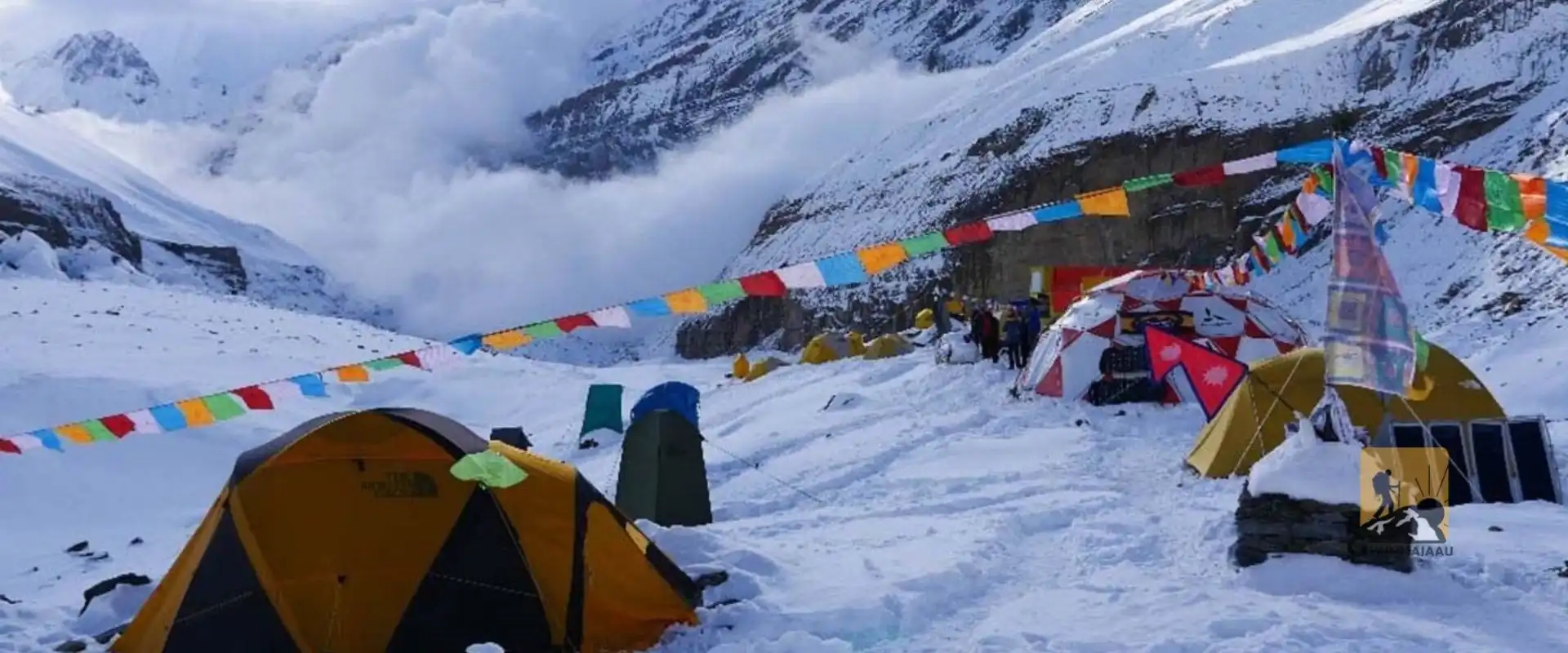
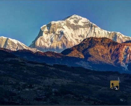
The Dhaulagiri Region in western Nepal is one of the country's wildest and least-crowded Himalayan areas. It is dominated by Mount Dhaulagiri I (8,167 m), the seventh-highest mountain in the world, whose name means "White Mountain." Here you will find huge glaciers, deep river valleys, high passes above 5,000 m, and Magar villages that see few visitors.
This guide covers the Dhaulagiri Circuit Trek, Dhaulagiri Base Camp, Hidden Valley, the best time to go, how to get there, permits, a sample itinerary and the safety points that matter most. The Dhaulagiri Circuit is a serious, camping-based high-altitude trek. It is best for experienced, well-prepared trekkers travelling with a licensed guide.
The Dhaulagiri massif lies west of the Annapurna range, separated from it by the Kali Gandaki, one of the deepest river gorges on Earth. The lower valleys of Myagdi are home to Magar communities, with terraced fields, forest trails and traditional villages. Higher up, the landscape turns to glaciers, moraines and snow passes. On the Mustang side, the dry trans-Himalayan villages of the Kali Gandaki show strong Tibetan Buddhist and Thakali influence.
Unlike the Everest or Annapurna regions, Dhaulagiri has no continuous chain of teahouses. Trekkers rely on a guided expedition-style setup, which is exactly why the region still feels remote.
Key highlights:
The Dhaulagiri Circuit is the region's signature journey and one of Nepal's toughest treks. It follows the Myagdi Khola upstream through Magar villages and forest, climbs into the glacial valley below the Dhaulagiri massif, crosses French Pass and Dhampus Pass, and descends to the Kali Gandaki Valley near Marpha and Jomsom.
Main stages on the route:
Camp locations and elevations vary slightly by operator and season, so treat these figures as approximate.
Dhaulagiri Base Camp sits below the huge ice walls and glaciers of the massif. It is a dramatic place for mountain photography, and also the point where careful acclimatization matters most. Rest days here and at Italian Base Camp help the body adjust before the high passes.
Hidden Valley is a remote high-altitude basin reached by crossing French Pass. With almost no infrastructure and stark, open terrain, it gives the circuit its strongest sense of isolation. Weather and snow on the approach decide whether the crossing is safe, so timing is flexible.
Dhorpatan is Nepal's only hunting reserve, with forested hills, alpine grasslands, wildlife and traditional settlements. It is a separate area from the Dhaulagiri Circuit, spreading across several districts, and suits travellers who want nature, birdlife and quiet trails instead of glacier crossings.
Explore more: Dhorpatan
The Gurja Himal area (peak 7,193 m) and nearby Myagdi villages offer quieter forest trails, traditional Magar settlements and Himalayan views. Facilities are limited and route conditions change, so plan these routes in advance with a local operator.
Upper Mustang and Dolpo are separate trekking regions, not stops on the Dhaulagiri Circuit. They can be linked in a longer Himalayan itinerary, but each needs extra time, its own permits (Upper Mustang and Upper Dolpo are restricted areas) and separate logistics.
The classic Dhaulagiri Circuit starts from Beni, the headquarters of Myagdi District.
Road quality on the Myagdi side has changed in recent years, and some expeditions now approach from the Marpha and Yak Kharka side instead. Always check the current route and access with your trekking agency.
Autumn (September–November) is generally the most stable season, with clear skies and good mountain visibility. It is the most popular window for the circuit.
Spring (March–May) brings blooming rhododendrons at lower elevations and improving weather. Snow may still sit on the high passes in March and early April.
Winter (December–February) brings severe cold, heavy snow and a high risk of blocked passes. The circuit is generally not recommended in winter.
Monsoon (June–August) means heavy rain, landslides, leeches in the lower forest, and poor visibility. Not recommended for the full circuit.
Recommended seasons: Spring and autumn, always subject to current snow and weather conditions.
This is a framework only. Your guide will set the final schedule based on acclimatization, weather, trail conditions and group fitness.
The Dhaulagiri Circuit is a serious high-altitude expedition. A qualified guide must decide acclimatization days, camp locations and whether it is safe to cross each pass.
The lower villages are mainly Magar, with farming, festivals and hospitality that reflect western Nepal's hill culture. Toward Marpha and Jomsom you enter Thakali and Tibetan-influenced country, famous for apple orchards, apple brandy and Thakali food.
On the trek, expect:
Ask permission before photographing people, dress modestly in villages, and follow local customs.
Do not expect the lodge-to-lodge comfort of the Annapurna or Everest trails. A well-planned camping expedition is the safest and most comfortable way to do this trek.
Permit rules depend on your route, nationality and the regulations in force on the day you travel.
Fees, guide requirements and permit conditions can change. Confirm the current requirements with Nepal Tourism Board, the relevant conservation authority or a licensed agency before departure. Permits for neighbouring regions do not automatically cover the Dhaulagiri Circuit.
Before you go
On the trek
Insurance: Your travel insurance should cover trekking up to at least 5,500 m and emergency helicopter evacuation.
How difficult is the Dhaulagiri Circuit Trek?
It is one of Nepal's most demanding treks. Expect several days above 4,500 m, two high passes, glacier terrain and basic camping. Previous high-altitude trekking experience is strongly recommended.
How long does the Dhaulagiri Circuit take?
Most itineraries take 17–21 days including acclimatization and spare days.
Is Dhaulagiri a teahouse trek?
No. The remote sections are camping-based and need a full support team.
When is the best time for the Dhaulagiri Circuit?
Spring (March–May) and autumn (September–November).
Can I do the Dhaulagiri Circuit independently?
It is not recommended. The route is remote, partly glaciated and needs camping support and local knowledge. Confirm current guide requirements with an agency.
What is the highest point on the trek?
French Pass, at about 5,360 m.
The Dhaulagiri Region is for travellers who want Nepal's Himalaya without the crowds. For experienced trekkers, the circuit is a demanding but deeply rewarding journey. For those who want something gentler, Dhorpatan and selected village routes in Myagdi offer another side of western Nepal.
Ghumnajaau Pvt. Ltd. plans guided treks and customized journeys across Nepal, with local expertise and careful preparation.
Contact Ghumnajaau to plan a guided Dhaulagiri Circuit expedition or a personalized western Nepal adventure.
Ghumnajaau – Explore Nepal Together.
We create unforgettable trips, customized for your group.